General
The Writings of LaVarr B Webb
Utah's Dixie gets hot in the summer--110 degrees some days. The deeper holes of North Creek and the Virgin River were, and I guess still are, a joy in the summer to small boys. North Creek heads up on Kolob, makes it's way across the Kolob Plateau into Zion Park, cuts its way down, down, down through the Navajo Sandstone formation, gnawing like a hungry, but patient, dog, carving rooms, slippery slides, and vertical falls within the vastness of the multi-colored rock, then it flows out into a very narrow canyon with sandstone walls many hundreds of feet high, framing, generally, a blue, blue sky, a blazing sun, and, sometimes, towering, growling, thunderheads. Then the creek heads down canyon, spreading out into a thin, very transparent sheet, dropping over minute one fourth to one half inch water falls, washing at the roots of tall fir trees, shrubs, wild flowers, and grass, then coming together to rush down solid sandstone chutes into intricate solid sandstone pools, carved, again, by the pervasive water.
A few miles downstream, the water slows down, and works its way around and over boulders of all shapes and sizes. The boulders protect a very unique fish that swims like a trout, darts back and forth through the water like a trout, and, except for its mouth, is shaped like a trout. We called those fish rock suckers. They had a mouth shaped like the business end of a vacuum cleaner, and they grazed over the moss and algae covered rock like cows cropping grass in a meadow. When frightened, those fish would disappear, slithering under rocks, and hiding until bottom crawling, nude little boys went away.
That was my first introduction to fishing. As I stretched out and pulled myself with my arms through the clear water, I noticed the fish sneaking under the rocks. Sometimes I would see their tails sticking out, waving back and forth in the current like tillers on small boats. It was only natural that I would try to catch them, and soon I found it relatively easy to thrust my hand under a rock and grasp a slithery,
slippery fish.
We tried catching them with a bent pin tied to a piece of string, with a worm or a chunk of bread for bait. The fish seldom went for the worm, and the bread fell off the hook soon after it hit the water, so we always ended up fishing with our hands. I had one problem though. Sometimes, as I clutched for a fish, my hand closed around an insect larvae--a hideous bug that we called a water scorpion. Oftimes, it would attach itself to the back of my hand, and crawl with prickly clawed feet up my arm, leaving behind two obvious pin prick trails. When I found that creepy, crawlly bug in my hand or crawling up my arm, I always yelled and tried to brush it away, but many times it would cling until I found a sharp stick or stone, and scraped it off.
One hot summer day around 1927, about a half of a dozen of we Virgin City boys had been up on North Creek floundering around in the cool water. We had caught quite a few fish ranging in size from eight to fourteen inches, and we had strung them on willow poles. We were trudging down the hot, dusty road, in our overalls, with no shirts, and bare feet, with our fish dangling from the willow poles slung over our backs, and looking like escapees from a Mark Twain classic, when a big black car pulled up in front of us and stopped. A woman climbed out of the car and asked us if she could take our picture. Of course we were shy, but we posed like a bevy of Huck Finns, and she got her picture. Now, as I look back, I wish I could see that picture. I was proud of that catch.
 I've been involved in the outdoor recreation industry for many years, mostly as a writer and photographer. This site is an archive containing some of that work, along with reports about new adventures.
I amble around, mostly in the American Southwest, seeking beauty, serenity, wonders, and mysteries. I'm now winding down my business and will have time for serious adventure travel. Follow along, if you want.
Find me on: Facebook | Youtube
As a fisherman, I've noticed people often go through distinct phases:
- I want to catch a fish... any fish.
- I want to catch lots of fish.
- I want to catch big fish.
- I want to help others learn to fish.
I'm Dave Webb, and I'm at phase 4. I run this site, with help from family and friends, and I hope it provides ideas and information to help people learn to enjoy outdoor recreation.
I believe hiking, fishing, camping, and other outdoor activities are very beneficial, particularly to families and young people. They teach valuable skills, promote teamwork, and help people develop confidence.
I am not a guide. I simply go on adventures with family and friends. I get out more than they do and so I'm always looking for new companions. I'll post a list of my upcoming adventures on my trips page. If you are interested in one of my adventures, then reach out and maybe we can help each other.
I'm also happy to answer questions and provide resources, as much as possible. I have quite a collection of outdoor gear that sits on the shelf most days. I'm happy to share some items, to encourage people to get out as they learn skills and acquire their own equipment.
Back in the day, I helped publish a print magazine, which went through several incarnations: Utah Fishing & Outdoors, Utah Outdoors, and finally Amazing Outdoors. I have posted many articles from that magazine to this site and will continue to add more as I have time. The site has a tremendous amount of information, and it has been a challenge trying to organize it so it is useful. I have much work to do but I'm pleased with how it is coming together.
We are also writing and acquiring new articles, photos, and videos that will be published here.
I'm old and semi-retired. I now have time and resources to enjoy trips to some of the better adventure spots around the region (and a few international). I'll post ideas and reports as I make those trips.
This site's Facebook page shows current information about outdoor recreation in the red rock area. You can contact us via Facebook, or use the contact form on this website.
Click play on the image below to see some covers from our old print magazine. Many articles from the magazine are archived on this website.
Please use the form below to contact us. We will respond asap.
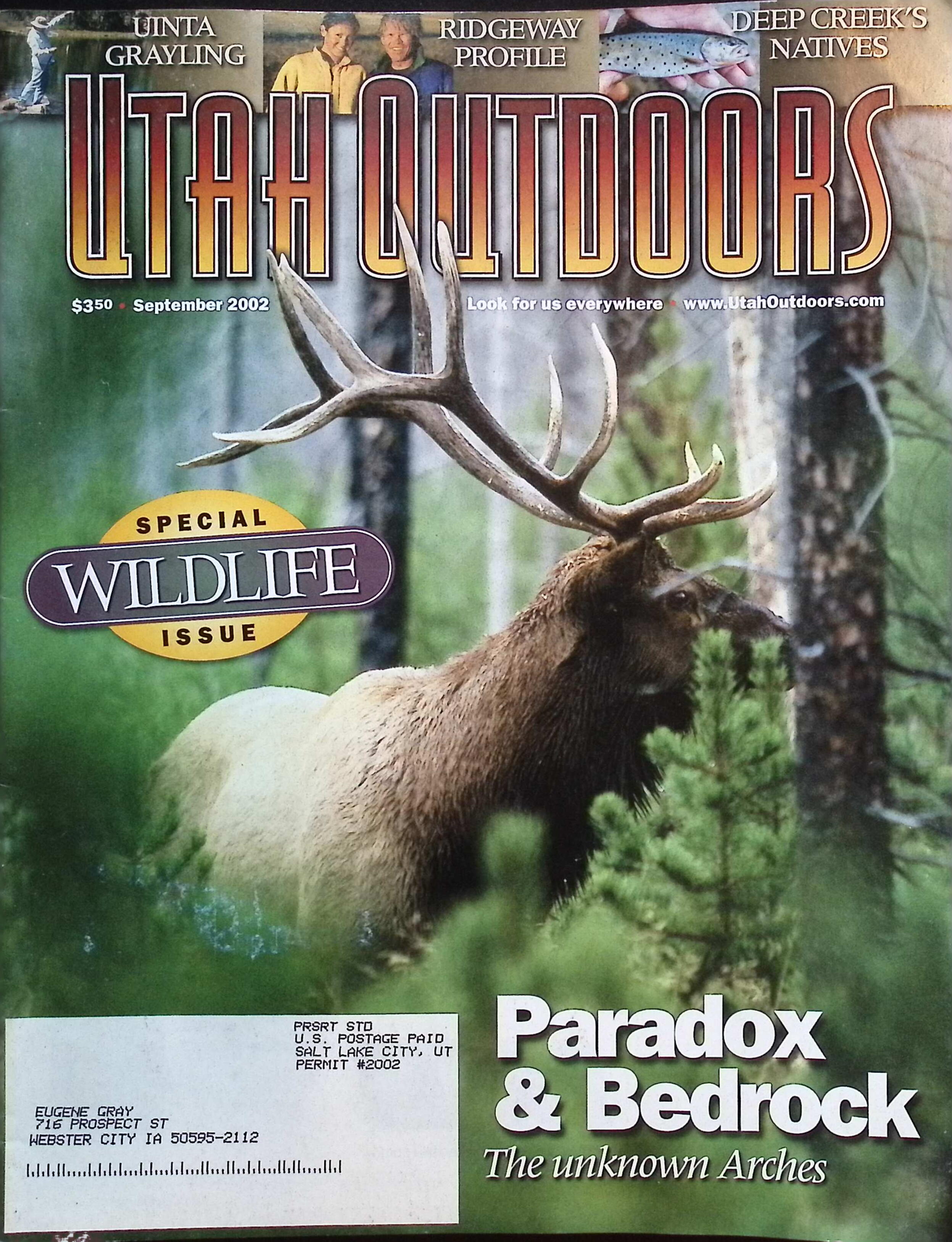
Click on the image below to see a slideshow showing some covers from our old print magazine. Many articles from the magazine are archived on this website.
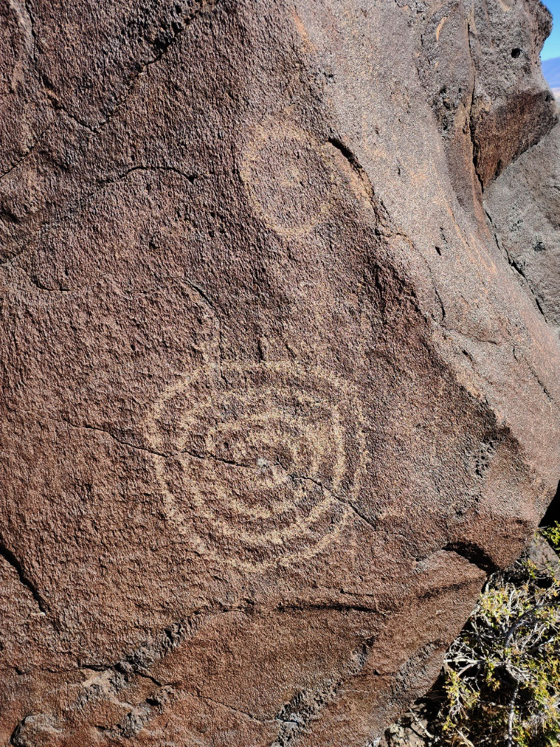
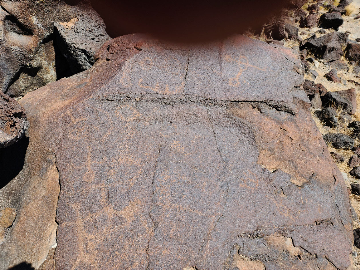
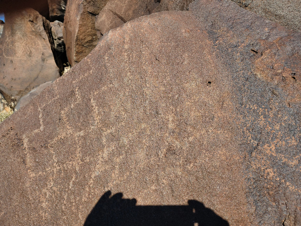
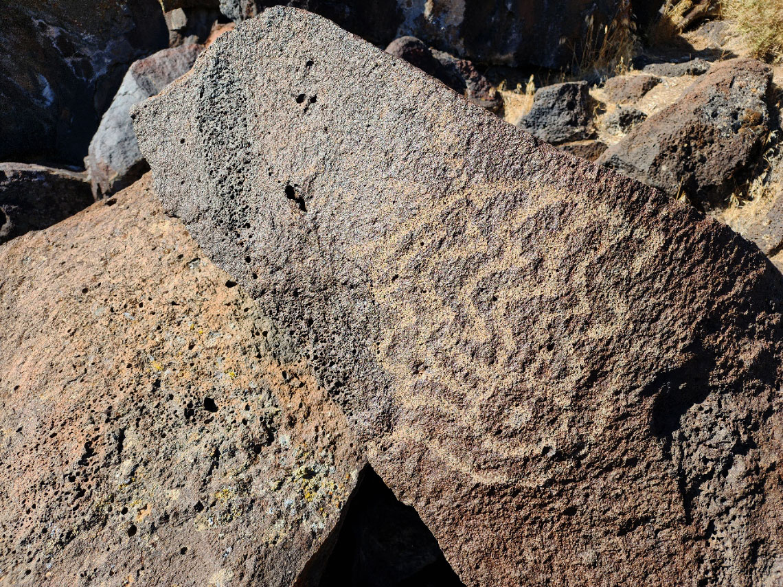
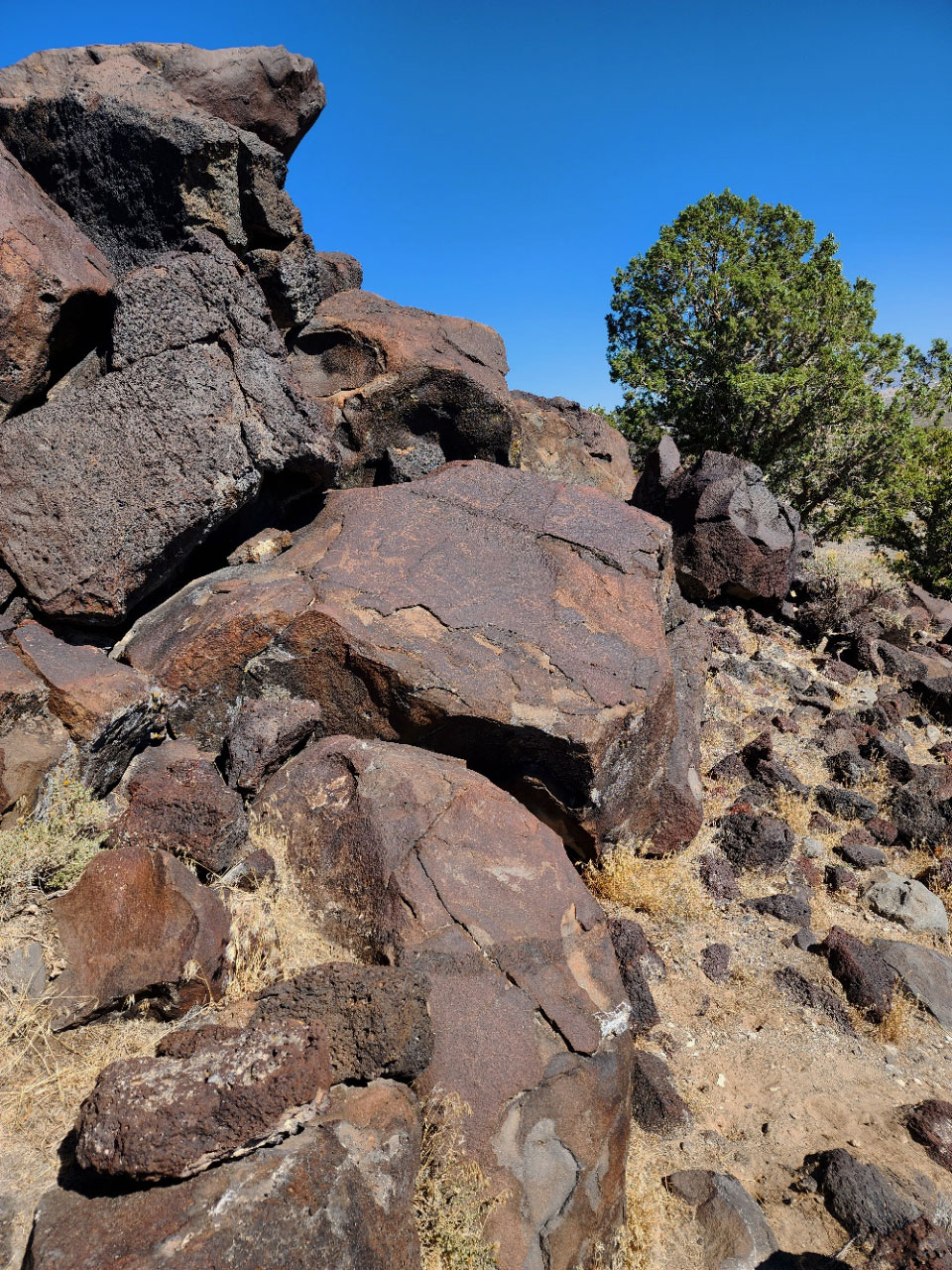
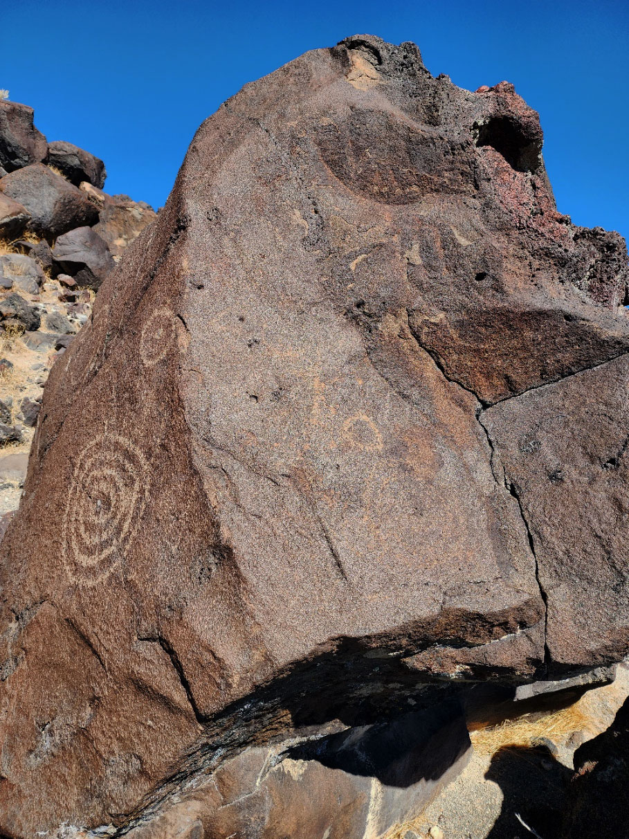 There is interesting rock art carved into black lava rocks west of Fillmore, in west central Utah. The area is known as the Devils Kitchen and is found along the Pahvant Valley Heritage Trail. People enjoy exploring the area using all terrain vehicles.
(This is not the Devils Kitchen scenic area in the tops of the mountains along Nebo Loop. This is low desert country.)
If you are in the area, it is worth searching out the rock art here. But the rock themselves are not particularly unique or impressive and, in my opinion, it is not worth a special trip just to see them. There are plenty of more impressive sites in the region.
The tiny farming community of Flowell UT, west of Fillmore, is the jumping off point for visiting Devils Kitchen. From there, the good gravel Clear Lake Road skirts lava fields as it runs NW up to the Clear Lake Waterfowl Managment Area.
The Devils Kitchen turnoff is clearly signed and easy to find. From the turnoff, a rough dirt road heads up to the rock art area. The trailhead is clearly signed and is also easy to find. However, the access road has deep ruts filled with very fine sand. All terrain or at least high clearance four-wheel-drive is need to reach the trailhead.
GPS for the trailhead: 39.055376, -112.508980
You can see some rock art images from the trailhead. Walk up the hill to the lava rock and search around for more. It is worth spending an hour or two examining the boulders for rock art.
This is dry Great Basin desert landscape. It gets very hot during the summer. Winter days are often mild but winter nights can be bone-chilling cold. The dirt access road may not be after storms.