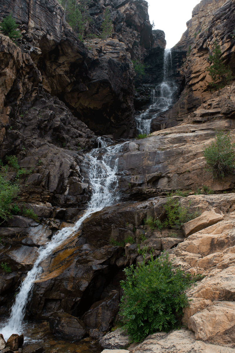
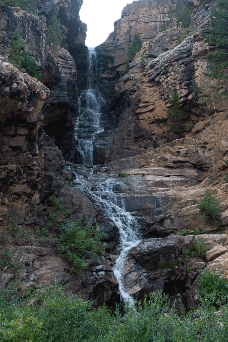

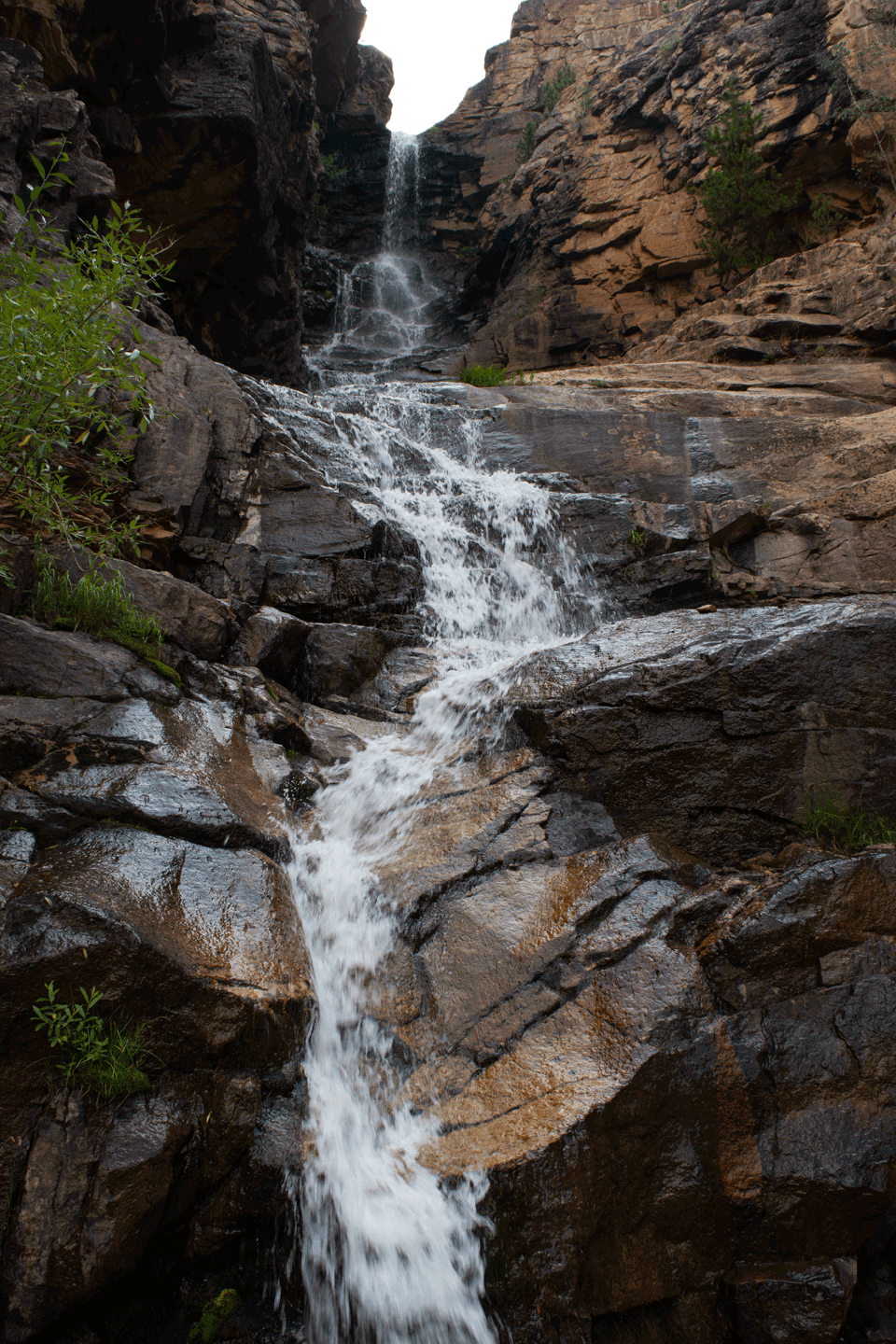
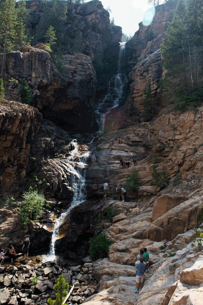
There are several waterfalls on Little Deer Creek, a tributary to the Duchesne River, in the Uinta Mountains. A rugged 4X4 road leads to the base of the most impressive. Others can be seen by hiking up the stream.
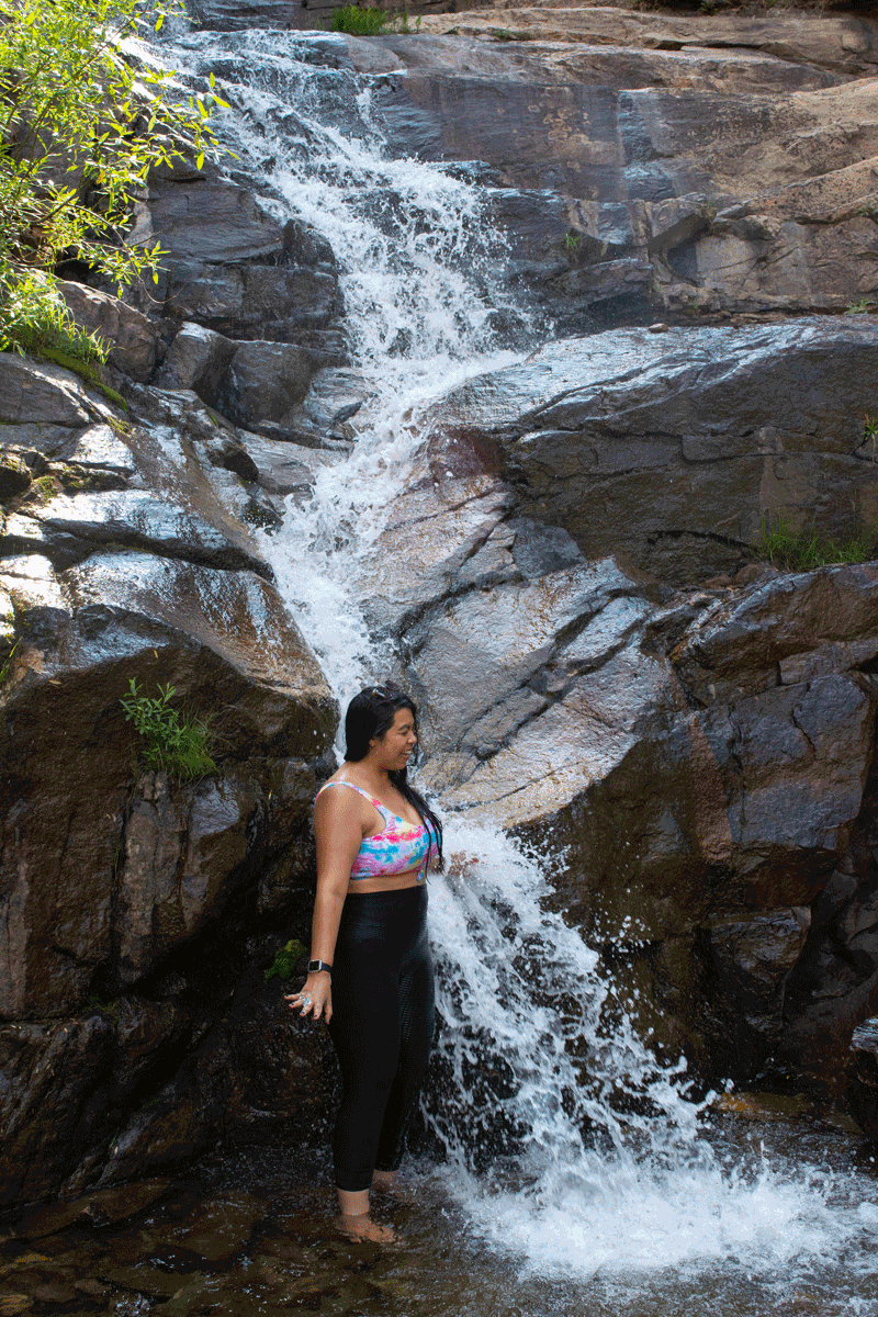
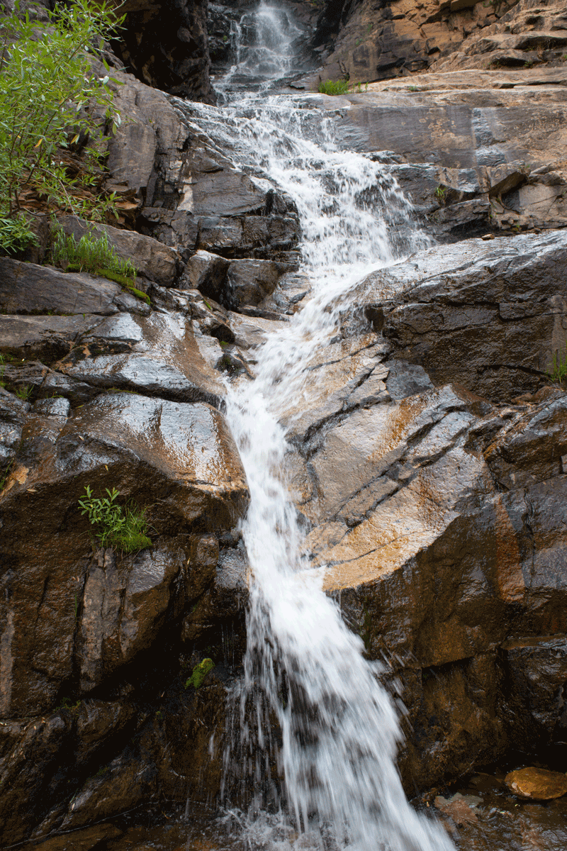
Our photos show the main waterfall. The stream is small and we visited in late July (2021), in a drought year, but there was plenty of water to create a spectacular, photogenic scene.
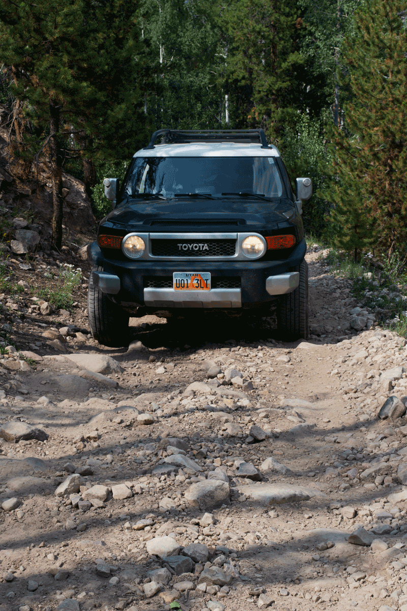
There are many waterfalls in the Uinta Mountains. Most can only be seen by hikers/backpackers. This one is popular because you can reach it by vehicle, albeit you do need high clearance four-wheel-drive. The road is narrow and extremely rocky, with some large rocks and deep holes.
To reach it, drive Highway 150 east from Kamas into the mountains. Turn right (east) onto the Murdock Basin Road (137) and then right (east) again onto Route 027. Follow 27 down to the East Portal reservoir and continue following it along the reservoir to the base of the waterfall.
Google Maps shows the route but stops above the reservoir and suggests you walk south to the stream. That works but puts you above the main waterfall. Hiking downstream to the base of the main waterfall is possible but arduous. Most people do better following the road around to the base.
The road is good and suitable for any vehicle until you are about tree miles away from the waterfall. Only the final portion requires high clearance. Some people park where the rough section begins and hike to the waterfall. There are many nice dispersed backcountry campsites in Murdock Basin and along Route 27.
Waterfall coordinates: 40.621638, -110.890409