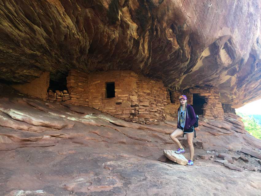
*There are 8 sites in Mule Canyon, home to ancestral Puebloan ruins and rock art, all within 4 miles.
*There are day use fees and pay stations located in different areas of the mesa. Backcountry permits are required for camping along the mesa, obtainable at the Kane County Ranger Station, on UT-261, from 8:00 a.m. to 12 Noon.
*Muley Point is overseen by the National Parks service, however there is no camping fee.
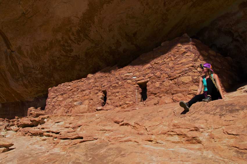
Horse Collar Ruin by Aaron Webb
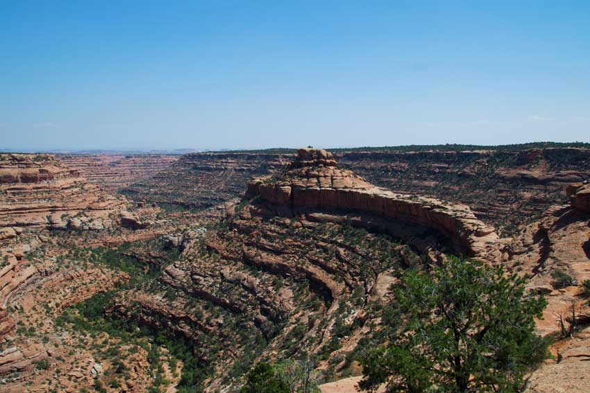
The Citadel Formation by Aaron Webb
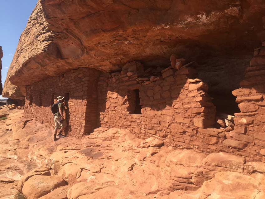
Citadel Ruins by Xan Aintablian
By Xanthe Aintablian, September, 2017
I remembered many times standing at the tip of Muley Point, up from the Moki Dugway and above the Valley of the Gods. We’d venture out of our way up to Cedar Mesa as a long-way home, after spending time in Monument Valley. Some of these trips were with many of my extended family, caravaning together up the treacherous switchbacks of the dugway. Sometimes the trips were just with my father.
As a child, I’d always get out and just stare at the view. I loved the colors and shadows of the valley below. I’d run around the big pot holes at the top of Muley Point, and jump on the giant stone slabs, layer to layer. I wanted to stay longer, every time, but we always had a destination further up the road.
For over a year my brother and I talked about a scouting trip to the mesa as a way to explore and look for kid-friendly hikes we could take each of our own young families. My brother had similar recollections to mine, but told me of another favorite memory in the area.
He once hiked a canyon near the mesa where he remembered seeing an enormous peninsula, of white sandstone. It looked like a giant stone fortress, and he thought he’d remembered seeing ruins on top. He and my father had hiked to a ruin below it, but he had always remembered how badly he’d wanted to go explore that castle.
We set out on a friday to revisit a piece of our childhood. We left much too late, which we should really just accept of ourselves now, and due to stopping in Moab for dinner and gear, we arrived driving west on UT-95 just as the sunlight was receding behind the mountains.
Cell service was in and out but in a moment of clear satellite signal, my father called and spoke to my brother. He described the castle area he remembered, and my father recognized the description and guess it was Road Canyon. My father also might have mentioned that it was the very same place I’d broken his expensive camera lense many years ago. Like I said, I’d had too much fun as a child jumping from rock to rock - not a good idea when I’d been entrusted to carry a camera strapped around my neck. I’d not remembered it had been in Road Canyon, nor did I remember the peninsula that had intrigued my brother so much.
Mule Canyon
We decided to hike Lower Mule Canyon at first light the next morning, so we pulled off and camped beside that access road. I slept outside under the stars and awoke several times that night with a range of moods. Sometimes amazement, as my eyes immediately were caught by the bright Milky Way and billions of jewel stars right in front of me. Sometimes in awe of the orange setting moon, and wishing I could see more moonsets. Once I awoke to annoyance, a lucky annoyance as I see it now, as the lone solitary mosquito pestered me for a few minutes. And once in fear as I heard the sound of coyotes howling and yelping around me. I just tried to remind myself that coyotes were probably harmless and fell back asleep.
When I awoke in the light of the morning, I was eager to start out early. I woke my brother so we could pack up and hike Mule Canyon in the cool morning air. The trailhead was only about a quarter mile from our camp. We quickly grabbed what gear we needed, and set off.
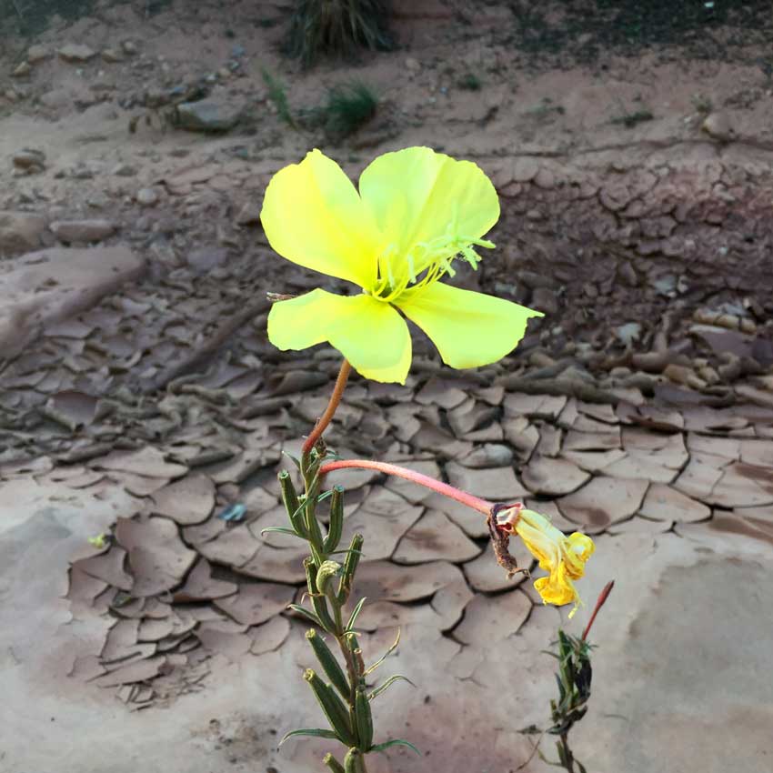
The wash was thick with wet, clay mud, cracking on the surface. Tiny toads bounced along everywhere we walked, startled by our sudden presence. Colorful wildflowers bloomed everywhere, which I was surprised to see in early September, and colorful sunlight was beginning to bounce and shine off the redrock walls.
We hiked to House on Fire ruins, located on the east (right-hand) side on the canyon .9 miles from the trailhead. The ruins, fairly large and well-preserved, were impressive. The name is derived from the colorful and unique streaking of the rocks and cliffs surrounding the ruin. We’d read that when illuminated in sunlight, around 10 or 11 in the morning, the site can almost appear aflame. Since we’d reached the site at about 9 a.m., we decided to continue hiking up the canyon to the next ruin, before making it back to House on Fire for the morning illumination.
We hiked for what seemed like about another mile, but didn’t see the next ruin. We had left our area guidebook back in the car, and since we didn’t remember how much further the next site had been, we decided to turn back to House on Fire again. Look back, the next site is located 1.9 miles into the trail. We’d probably been so close. We sat at House on Fire for an hour, now also hosting four other visitors. We chatted and watched the sun rise up from behind the canyon. It perhaps wasn’t quite as dramatic as I’d heard it described, but the sun did light up the cliffs, creating contrast to the interesting “flame” markings.
Road Canyon - The Citadel
When we had sat and seen enough, we hiked back out of the canyon, and continued on our way. Stopping in at the Kane County Ranger Station seemed like a good idea. We checked and followed their recommendation on how to access Road Canyon. We followed UT-261 south, took Cigarette Springs Road for about 3.5 miles to the parking and trailhead.
Road Canyon has several hikes that drop down into the canyon, including Fallen Roof Ruins, a shorter, moderate hike, and Seven Kivas, a long, rigorous trail. We wanted to reach the Citadel, the fortress above the canyon. We followed the trail along the top of the rim, easy and flat, though hot in the afternoon sun.
I had never seen such a thick crust of cryptobiotic soil anywhere. It was inches thick, undisturbed, and allowed to grow black with white growths all along the trail above the red dirt. Except for the narrow trail, the black crust was only disrupted by the white stone canyon rim. Along the rim, we kept our eyes scoping the canyon walls for ruins across the way. My brother spotted three tiny windows which gave away a ruin far across the canyon and high up. From our distanced vantage point, we tried to consider the ways the ancient Anasazi climbed down to it.
Eventually, I spotted the peninsula, or more the narrow bridge leading to the Citadel, that my brother described. When we got close, we didn’t spot any cairns leading the way, but the direction was clear enough. We had to backtrack a few hundred feet when we realized we couldn’t climb down. It was a steep scramble down several ledges. We kept realizing we needed to be down one more level, the closer to the bridge we came. My brother had no issues, but my slightly-paralyzing fear of falling kicked in and I had to take several deep breaths before crab-crawling on my hands and feet, back to the wall, down the white rock.
Once you are on the bridge level, it is once again an easy flat walk, straight across to the citadel. There are several ruins on two different levels around the Citadel. They were excellently preserved, like House on Fire, and conveniently provided a lot of shade. We rested for a long time. There was such a good view of the canyon from all sides, it was easy to imagine the ancient people defending and watching from up there.
On the way back, seeing what I’d already scrambled down made me even more nervous, as I had an even better view of the steep fall. I searched long and hard for the route back up that I felt most comfortable with (and may have let my brother help me quite a few times). The walk back was flat and easy again - probably close to 2 hours worth of hiking.
Muley Point
After we returned from Road Canyon and left Cigarette Springs Road, back on the pavement of UT-261, we decided to make a quick visit to Blanding to restock some ice before heading to Muley Point. That was my pick. I wanted to camp there, experience sleeping on the edge of the mesa, and really just get to spend more time there. We were just 5-10 miles south of the point when the sun set behind the mountains, which was a disappointment. I had wanted to sit at the edge watching the shadows and light run across Valley of the Gods. However, the next morning’s sunrise made up considerably.
I had a spectacularly clear night, the moon a little too full for terrific stargazing (and I made a mental note to come again on a night with no moon), but still an amazing and full night sky. The 3 a.m. half-asleep peep at the sky provided another glowing orange moonset, and a darker sky more full of stars. I slept only about 30 feet from the edge of the mesa, and I felt the exact kind of excitement I thought I would have felt as a child, sleeping in my favorite spot, 1,000 feet above the valley floor. When I woke in the morning, the sun climbed higher and higher moving light across the valley, as I’d hoped I would see the night before.
I don’t often run and jump around the rocks anymore like I did as a child, mostly because even in my late 20’s, I already feel more aches and stiffness, but something about the energy of that area for me just powered me up. I ran along the edge of the cliffs back and forth several times, stopping to glance at how the light changed things. I felt like a kid again. We took some photos while the sunrise remained, and I soaked in some moments before we packed up our sleeping bags and headed to our next destination.
Sipapu Bridge, Horse Collar Ruin, Natural Bridges National Monument
My father had recommended that if we had any time remaining in our trip, we hike to Horse Collar Ruin in Natural Bridges to take some photos for him. From Muley Point we heading back north on UT-261, took a left going west on UT-95 to Natural Bridges. The Horse Collar Ruin is located along the same trail as Sipapu Bridge, about a mile past the bridge.
The hike down to Sipapu Bridge is steep, descending down to the bottom of the canyon. The park provides stairs, ladders, and chains to aid in several places. Once at the bottom of the bridge, the trail to the ruins follows the bottom of the river bottom, flat and easy. The ruins are on the right-hand side, up a sloped wall from the bottom.
There is a cluster of some well-preserved and unique cliff dwellings. Hikers can see it well from the river bottom, or choose to scramble up closer to them.
While the trail to Sipapu Bridge is more crowded in the peak seasons, the remaining trail to the ruins was fairly deserted. Hikers can also complete the entire loop, continuing past the ruins instead of returning, to the other two major bridges in the park, an 8.6 mile hike. Unfortunately, we didn’t have the time to hike the full loop, so we returned to Sipapu and hike back out.
It was a quick, but terrific glimpse into the national monument.
The entire trip was a quick glimpse into the Cedar Mesa area. I feel we accomplished a lot of what we’d hoped to find in the two nights and day and a half of visiting. We each revisited a place special to our memories.
We’d reacquainted ourselves with the area a bit more, enough that we could confidently take our children to hike with us. The older kids (8 and up), my nieces and nephews, could have hiked anywhere that we’d gone and been fine with a little help from their dad. My littler ones (3-5) could have hiked Mule canyon with a little help from me, and at Natural Bridges.
All in all, a successful mission.

