 Dave Webb
May 1, 2023
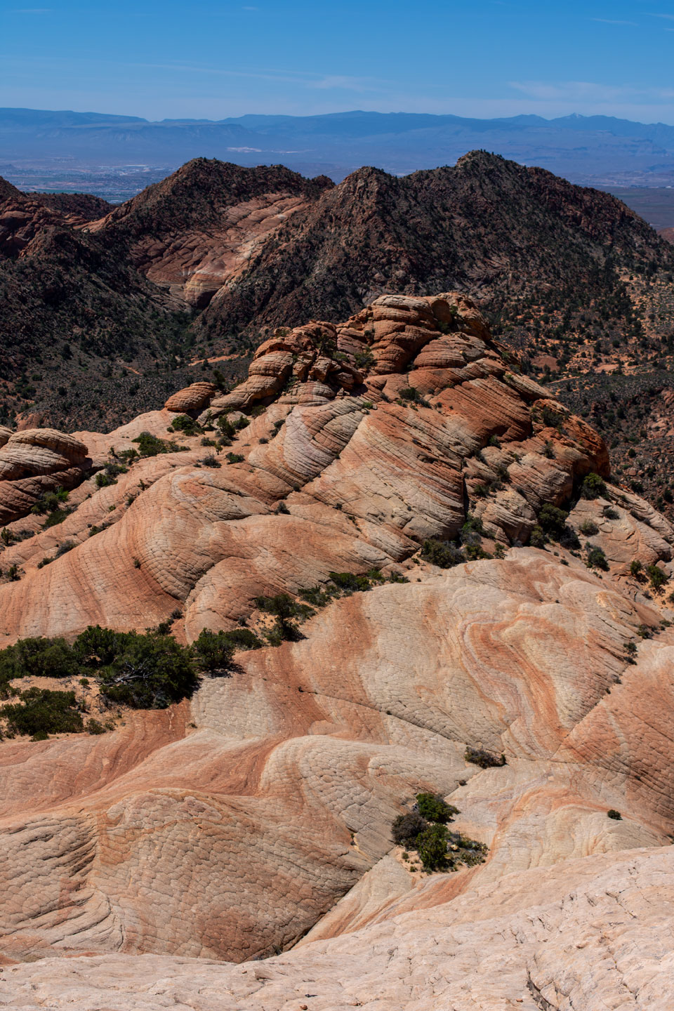
The Candy Cliffs hike, near St. George, has long been a favorite and in recent years it is becoming popular. The basic hike is great for families with kids and the route can be extended to provide a good little adventure. The trailhead is easy to find and it is close enough to town that is makes a great half-day outing.
The trailhead is in the juniper/pinion forest partway up Pine Valley Mountain. The trail runs for about 1.1 miles south, along a gentle upward slope, to the rim above the cliffs. Views are outstanding in all directions. You can stop, relax, eat, enjoy the view, and then return the way you can, for an easy 2.2-mile hike.
More adventurous people can easily descend a natural ramp into the cliff area and then hike to their heart’s content. You can climb castles and dance over rainbows as you explore the taffy-colored cliffs.
This is a great spring/fall hike but can be enjoyable early in the morning even during summer. The trailhead is at an elevation of about 4590 ft, so quite a bit higher and cooler than St. George. The trail runs through trees but has full sun exposure. Summer mornings are delightful but afternoons are hot.
We hiked during the middle of the day on April 30, 2023, during a spell warmer than normal for that time of year. It was feeling hot when we made our way back down the trail.
During winter and early spring, the area receives snow. You do ford small streams as you drive to the trailhead. Most of the time that is not much of a challenge and crossover-type vehicles and easily make it. When we visited, spring runoff was extraordinarily high and so the small steams had good flows, but we had no trouble in our 4x4 vehicle. Most of the road was dry but there were deep ruts and many washboardy spots. As the season progresses, they will grade the road and so it will be an easy drive.
Driving to the trailhead during the dead of winter would be challenging, even with a serious 4x4 vehicle.
The area is in a transition zone between desert and alpine forest and has a wide diversity of plants and animals. There are several kinds of cati plus wildflowers, shrubs, and pinion pines. When we visited, the wildflowers were in full bloom but the cacti were just budding out. We did see a cute rattlesnake, that hustled off the trail after buzzing to warn us to give it room. Lizards, rabbits, porcupines, foxes, bobcats, coyotes, cougars, mule deer and many other animals inhabit the area. Wildlife is almost never a problem. If you hike in a group, make noise, and mind your own business, most people will never know they are in wild country.
To reach the trailhead, drive north from the town of Leeds through Silver Reef and along the red cliffs into the mountains. About two miles above Silver Reef, the road forks. The right fork goes to the beautiful alpine Oak Grove area. Take the left fork and drive about 7 miles, past the Danish Ranch, to the obvious trailhead.
The road continues west and then drops down into the town of Washington. You can reach the trailhead from that direction but the road is rougher on that side.
Trailhead GPS:
Lat: 37.234684
Long: -113.477017
Rim above the cliffs:
Lat: 37.220213
Long: -113.473599
The map below locates the trailhead.


