Exploring Cedar Mountain
By Sam Webb
WOW, it's getting hot out there and that means it's time to head into the high country. And, one of those high country get-a-ways you should check out is Cedar Mountain.
A person could spend the whole suminer on the mountain and still not see it all. So, where is Cedar Mountain? Point your car toward Cedar City and then take State Highway 14 up onto the mountain.
And, what do you do when you get up on the mountain? First, check out Cedar Breaks National Monument. Turn north on Highway 143 (offof Highway 14) and in just a few miles you will be there.
The place to start is at any one or all four of the scenic overlooks. You'll be at about 10,400 feet in elevation so evenings will be cool even on the hottest of days.
The national monument is a huge amphitheater almost 2,500 feet deep adorned with pillars, spires and all kinds of weird shapes- decked out in brilliant pinks, reds, purples and yellows. Don't forget the camera.
Take time to hike one of the nature trails and to check out the bristlecone pines. Some of these ancient trees are over 2,000 years old – the oldest living things on the earth today. If only they could talk, what a story they could tell!
Spend some time at the visitor center. It was built in 1938 by the Civilian Conservation Corps.
Oh, and if you are into mountain biking, this is the place. Get a map at the visitors center and then point your bike down one of the many trails. Cedar Mountain provides some of the best summer mountain biking anywhere. (Biking is not allowed in Cedar Breaks itself.)
For more information about Cedar Breaks National Monument give them a call at 1-801-586-9451.
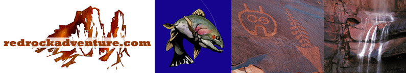
Next, grab your fishing rod and head for Navajo Lake. Navajo is a natural lake at about 9,200 feet elevation. There are three campgrounds and a lodge at the lake.
Navajo Lake contains a good population of BIG brook trout and lots of rainbow trout. Fishing is generally good from the shore but if you want to chase down one of those big brook trout you'll need a boat or float tube. The brook trout seem to be especially fond of feather jigs. Pearl, rootbeer, dark brown and black are generally productive colors. The brooks also like big, minnow imitating streamers, wooly buggers and leeches in the same colors as above.
As you explore Navajo Lake you will quickly discover that there is no outlet stream! Plenty of water comes into the lake but there isn't any evidence of any water going out, yet the lake doesn't overflow its banks.
So, where does the water go? Apparently at least some of it goes into a series of lava tubes at the bottom of the lake and then into the underlying rock. One place it comes to the surface is at Cascade Falls, just down the road a piece from the lake. From the parking area it's about a half mile hike to the falls over a well main-tained trail suitable for just about anyone. There is no drinking water on the hike or at the trailhead so take a canteen of water or a bottle of your favorite sports drink.
Just down the dirt road (east) of Cascade Falls is the Ice Cave. If you got a little hot while hiking to the falls, the ice cave will cool you down in a hurry.
As you climb down into the mouth of the cave, the temperature will drop dramatically and you'll find yourself standing on a huge mound of ice. The winter snows build up in the cave and then turn to ice as they are compacted. The cave is so cold that the resulting block of ice doesn't melt, even in the heat of the summer.
This cave was so dark and slippery that I didn't go back into it any distance and I don't know how extensive it is. Still, it's worth a look.
While we are on the subject of caves, it's time to explore Mammoth Cave. Mammoth Cave is the result of a series of tubes formed as lava flowed from an ancient volcano. The edges of the lava flow cooled more quickly than the center and so the center portion continued to flow after the sides hardened. This left an almost circular, hollow, tube through the middle of the flow. Some of these caves (tubes) go a long way under the surface.
If you are interested in exploring the tubes you will need spelunking gear and some powerful flashlights. Just a short distance from the entrance the tubes are pitch black and you literally can't see your hand in front of your face.
This is a place to be extremely careful and to make sure you know the way back to the surface.
There is no drinking water or restrooms at the mouth of the cave and there are no garbage cans. Take plenty of water with you and be sure to pack any garbage back out with you.
Ok, now it's time to check out Mammoth Spring and Mammoth Creek. Mammoth Creek comes bubbling out of the ground as a full blown stream at Mammoth Spring. It's amazing to see that much water coming to the surface between the rocks of the stream bed. Walk upstream 10 feet and the stream bed is dry. Walk downstream 10 feet and there is Mammoth Creek. Where does all that water come from and why does it come out in that one spot?
There is a small primitive campground near the spring but it's pretty small and can only accommodate three or four camp sites and only then if the campers like each other. Mammoth Creek has a healthy population of trout but you won't be able to fish much of the stream before you hit private property and a whole bunch of cabins built right on the stream bank. Don't fish the private property without getting permission first. I've never fished the stream because of all the private land, but I hear reports of some BIG brown trout coming out of the stream.
After a full day of exploring, you might want to relax and do a little bank or stream fishing. If so, point your car toward Duck Creek, Duck Lake and Aspen Mirror Lake. These three waters are just off of Highway 14 in the Duck Creek Village area.
All three waters are heavily planted with rainbow trout and fishing is generally fast. Franky, the area is so pretty, that catching fish is almost secondary to just sitting there and soaking in the scenery. These waters are very popular and you'll have plenty of company but if you don't mind the crowds, you'll enjoy yourself.
When I was there, there were three or four families of ducks learning to swim on the lakes and I got some good pictures.
If you are still looking for an adventure, ask yourself this question does Duck Creek go?" The stream flows out into a big meadow-like area and simply disappears. The map calls the meadow the Duck Creek Sinks. Is Mammoth Spring where Duck Creek comes back to the surface? And, if so, how does the water travel through the ground that distance? Or, does Duck Creek emerge somewhere else?
There is a campground right on Duck Creek with 80 camping sites and plenty of room for trailers and RVs. The campground is at 8,600 feet elevation so it'll get cool enough in the evening for a good night's sleep.
If you aren't into camping, point your car toward Duck Creek Village and check yourself into one of the inns or rental cabins and then stop off at one of the cafes for dinner.
Only one last thing to do and it has to be done before the sun starts going down. Schedule your day so that you can be at Strawberry Point at sundown. I can't think of a more beautiful place on the planet to be as the sun is setting.
Carefully walk out to the point and then sit down and wait. You'll be glad you did. Oh, don't wait until after it gets too dark to come back off the point. There are a couple of narrow places that could be dangerous in the dark.
Copyright Dave Webb